The weather forecast for today suggested that the morning would be fine but gradually turn to rain about 2 o'clock which would last for the rest of the day. Initially there was quite a bit of blue sky as we set off towards the Beeston locks.


We noticed that most of the tress are only just beginning to turn from green to their autumnal colours - whilst back home they seemed to have much more colour to them. This one had just a few splashes which stood out in contrast to the rest.

Looking back we could see Tilstone Bank, the hill which overlooks Tilstone Mill and Lock that we passed through just before we moored last night.


It was a short run to the first lock - Beeston Stone Lock. Alongside we spotted a pile of very new stop planks that looked very similar to those we saw yesterday at Calveley. The round lock keeper's huts are typical of many of the locks on the former Chester Canal.


Shortly after comes Beeston Iron Lock somewhat obviously named as it is constructed from iron plates in a design aimed at overcoming problems with the original construction (presumably also in stone) which arose from the sandy ground conditions. The walls have gradually distorted somewhat and so only one boat at a time is now advised - the joins in the iron plates can easily hang up a boat that hugs the wall too closely.

Just below the lock we could see close to the nearby railway line some unusual looking mounds with what appeared to be tunnels into them.

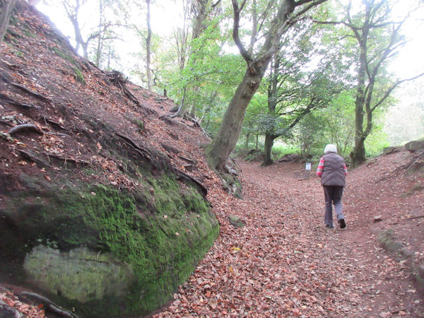
At Wharton's Lock we moored up just above as our plan for today was to walk to Beeston Castle, about a kilometre away across the fields. Fortunately there is a good footpath that leads directly there, starting from a kissing gate beside the lock.

As we walked across the fields we could see the sandstone crag looming above us, some 100m above the flat Cheshire plain. Little wonder that in medieval times this was considered a good place for a castle and easily defended.

It was about a 20 minute walk, the ;last party along a country road, until we reached the Victorian gatehouse - but first we went to the tea room just along the road for a cup of coffee.
Once inside we started to climb the hill - half way up there is the Outer Curtain wall with the old Inner castle right at the top.

This weekend the castle was hosting a range of outdoor activities aimed at families. A chainsaw sculptor was shaping this log into a small chair for a waiting small girl, waiting patiently with her dad.

We passed through the remains of the medieval gatehouse to the Outer wall. This was built with quite heavy defences, narrow slits for the archers to fire through at any approaching attackers.

Although much of the castle hill is now wild woodland again, the part just below the Inner wall is kept as open grassland, more like it would have been when it was fully occupied.

This main defensive castle is surrounded on one side by the sheer drops down tother plain below but on the sloping side a deep moat was cut into the rocks.

The Inner castle is now approached by a steep bridge that crosses the deep moat.

Inside the defensive wall is one of the most important features of any military castle: the well. Without this any siege would quickly defeat those holding out inside.


The view from the top is one of the main reasons why people come here. On a good day it is possible to see at least 30 miles almost all around. In the distance we could see the chemical works at Ellesmere Port and also towards Liverpool. Overall, we did not do too good a job at spotting the landmarks and we particularly failed to identify Chester and Jodrell Bank, both of which we expected to be rather obvious!

From up here we also had a better view of those tunnels that we saw earlier and just how extensive they are. When we returned to the information point we asked and were told that they were ammunition stores built during the Second World War. They have long since ceased to be used for this purpose and are largely now just abandoned although one person uses part as a store for reclaimed materials.


We spent quite some time at the top taking in the views in every direction. eventually we walked part way down towards the entrance but paused at a convenient bench to have our snack - not quite a packed lunch.
Time then to walk back to the boat - part way the rain showers that we had earlier seen in the distance eventually came our way. Fortunately we had packed waterproofs in the rucksack. We completed our lunch before dropping down the last lock for today with about five level miles ahead to our planned night stop.

By now it was rather wet and the view back to Beeston Castle was shrouded in drizzle.

The rain meant that photos were all much of a wash out. In any case, there is a long stretch of the Golden Nook moorings - all rather tatty - which kept us on tickover for some while. However, towards the end we followed a kingfisher for a little distance - it kindly posed on almost the last boat so that we could photograph it. It is a bit zoomed in and drizzly but at least it is clear who it is!
We continued a little further. We planned to moor close to Salmon's Bridge where there is a footpath across to Waverton Church which we plan to use in the morning. Unwisely, Mike turned down the opportunity of a good mooring bank (with a good chance of a tv signal) as it was a couple of hundred metres before the bridge. Thereafter the bank had been repaired with an environmentally friendly method that is not much use for boats - looks rather frail and encourages vegetation to grown in the water so that boats cannot really tie up. We continued through the bridge only to discover that the towpath was even less friendly to mooring so we reversed back to where we should have stopped in the first place. This is never a straight operation but we managed it and indeed there was tv signal! We could now light the fire and dry out.
7.4 Miles - 3 Locks
No comments:
Post a Comment