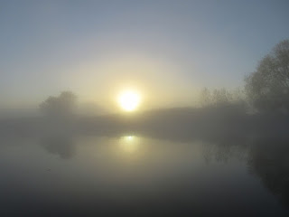
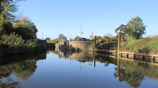
We awoke yet again to a significant layer of mist - the lack of any cloud above the mist enable Christine to take this somewhat surreal picture.
Before leaving our mooring, Mike walked up to the village for a newspaper. It is a pleasant, but probably largely commuter, village.
It has a village hall, pubs, substantial village green, a school that dates back to 1841 and a shop. The church is located in the original settlement a little apart from what is now the centre of activity.
One house has an old tree trunk carved into the shape of a snake. Just because something can be done does not mean it should be!
The pub sign depicts what the ferry might have looked like when busy.
By the time we left to go down to Tewkesbury the mist had all but disappeared.
Tewkesbury Marina is quite extensive and provides moorings on both sides of the river. We were inevitably amused to see another Alchemy.
We had to wait rather longer than we had expected before we could descend the lock to the River Severn as another boat was coming up having stayed overnight on the moorings just below. They did not find it easy to turn into the lock.
Eventually we were able to enter the lock and drop down to the level of the Severn. There is a short distance before we reached the junction onto the River Severn. \We immediately recognised that we were now on a much more substantial waterway than the Avon (which itself is much larger than most canals)
We had phoned ahead to Upper Lode lock so it was ready and waiting for us when we arrived. After attaching ourselves to the risers the keeper passed innumerable tips about navigating down to Gloucester - even though he had to talk down from a great height! The lock must be one of the most voluminous we have ever been in (and larger even than Gloucester Lock which we reached later).
There are few places to stop on the Severn - some belong to riverside pubs and make it clear that they are for patrons only!
After about two hours we reached Upper Parting where a narrower navigable stretch leaves the main stream to take boats down to Gloucester Docks. In the photo, we have just come from the right and heeded dire warnings not to continue down to the left! Here also is the point at which we needed to report our position to the lock keeper. He advised us that he needed a little time to pen through a work boat but should be ready in 25 minutes. As a result we slowed down a little (we had earlier been making just over 6 mph - whizzing along for us!) to time our arrival so that we would not have to tie against the wall - as per the Upper Lode keeper's instructions.
The gates were open again we were able to drive straight in. Although substantial, this lock is a more conventional rectangular shape but with a swing road brisge across it. We took some while to rise up to the level of the canal. The lock is sufficiently long that the keeper did not have to operate the swing bridge to allow us through.
The size of the lock-side bollard reminded us that we were entering a different world.
The dock is surrounded by former warehouses, many of which have found new uses but retained their looks. Some sites have been wholly redeveloped but close to the lock they fit in with their surroundings. A little further and more contemporary looks have been permitted.
Almost immediately we had to wait for the first of the movable bridges - a distinctive feature of this canal, each of which has to be manned and operated. We had to wait to allow a trip boat through before we were given the green light.
Immediately after the bridge we pulled onto the service mooring for water and elsan. After completing those tasks we went a little further to a mooring just outside a large Sainsbury where we were able to top up supplies.
After lunch we continued along the canal,passing a number of the bridges. This one was the only one which the keeper had to work by hand - should keep him fit!
Several of the bridges have sufficient headroom to allow us underneath but we still had to wait for a green light in case something is coming the other way.
Netheridge Bridge is very modern (opened in 2007) and involved a short bypass of the original route. It carries part of the Gloucester bypass. It is a lift bridge but it would require a rather large vessel to need opening.
Just before we reached Saul Junction we saw a sunken former barge - shows the size of craft for which the canal was designed.
By the time we passed through Saul swing bridge we were close to the time that the bridge keepers finish work so we moored for the night just after. This gave us a chance to eoplore the canals around the junction.
The Stroudwater Canal, later joined with the Thames and Severn, was the first canal to arrive here and dropped down through two further locks to connect with the River Severn. The entrance at Upper Framilode was not especially safe and the G&S was built later and avoided the more dangerous parts of the river.
Mike and Andrew walked down the route of the now abandoned section to the river much of which was built alongside the last part of the River Frome. Indeed, at first there is no sign of the canal and it would be easy to think that the navigation was the river.
The first lock of this arm has been re-built, but not to a navigable status as there is no plan to restore this part, although much work is being done to link the other direction to the Thames.
There is a section which still holds water, although the former basin and river lock seem to have disappeared completely. There are quite a few cottages along the line of the canal - the nearest of this row is today called Engineeer's Cottage.
The end of the road gives a wonderful view of the Severn estuary, across to the Welsh (Oh no they are not, they are English!) hills in the distance.
We also discovered a small parish church which describes itself as a 'Victorian Gem'. We were told that it was built by the wealthy local landowner for the use of the local residents of the Darrell Estate - most of whom were employed directly or indirectly by him! At that time the village had 600 inhabitants, now down to 100. The end is an unusual apse shape. An amusing account of life in Framilode can be found here. The church has recently been brought up to modern standards.
We then made our way back to the boat where Christine had tea and crumpets awaiting us.
Later, she and Andrew walked up the other direction to the end of the navigable part. Christine spotted a sign to another church but with signs that said that the access was private land but he owner graciously granted permission to walk down the drive for divine worship! Misbehave and the permission will be withdrawn.
23.7 Miles - 3 Locks


No comments:
Post a Comment