We initially walked under the pipe and railway bridges we could see from where the boat was moored.
However, at the first lock, they saw a sign indicating a cycleway from the other side of the bridge. It looked as if it went back on the opposite side to the towpath.
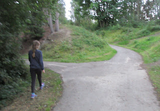
After a short distance it came under the large disused railway viaduct and turned uphill. Shortly after they arrived at a t-junction with 'CANAL' on the way they had come and nothing to the right but 'MIRFIELD' to the left. That puzzled a little bit as we passed Mirfield some time earlier in the day. Alice thought it worth an explore and very soon they emerged on top of the viaduct.
This seemed very wide, almost room for four tracks. However, the bridge under the road at the other end is much narrower, although it does appear to have been rebuilt for the cycleway.
We turned around but soon Alice noticed a path with steps and a hand rail leading downwards and she rather fancied finding out where it led. At first it was quite a good path but nearer the bottom it became almost jungle-like with growth all around.
Finally we came out by the river that runs close to the canal. We walked along the bank path, by now much clearer and saw the weir that keeps the higher part of the river at the required level. Next we came under the pipe bridge and viaduct but the path led onwards.
Some minutes later the path again became almost impassable, even though it was obvious that people do use this route. However we had not brought any form of navigation and were working by dead reckoning. We also realised that by now we had used up half of our available time. We could not convince ourselves that the path would come back across the river and to the canal anytime soon so we about turned.
We continued back up the path to the top of the viaduct where we had a good view of both river and canal.
At the t-junction we passed earlier we tried the third arm, hoping that it might bring us back over the canal at the previous bridge. However it turned up hill and across the railway line. We wondered who would sit on a bench looking down at the trains!
Later investigation revealed that the line over the viaduct was part of the LMS Railway's network of branch lines. It was planned as twin track but one was only ever laid. It seems that the intention behind a fairly short line was to provide greater capacity especially for freight traffic. Its seems that it was short lived. The line was modified to a much shorter length and joining other lines closer to Huddersfield.
It seemed amazing that so much work should be put into building such a massive viaduct for it to be a commercial failure. Fortunately it is not maintained by Sustrans as part of the National Cycle Network - and walkers can use it as well!


No comments:
Post a Comment